How Kilsyth Almost Got a Train Station

The 1850s was the decade of railway fever in Canada West. Every community from the tiniest hamlet campaigned to have a railway line – and the citizens of the Township of Derby were among them. We don’t know if the Flemings invested in railway bonds, but they must have followed the local Council meetings, and they eventually benefited from improved access to markets for their produce and greater ease of travel.

Image: The Toronto Grey and Bruce, Toronto and Nipissing, and Lake Simcoe Junction Railways 1877. Adapted by Rod Clarke from map of the Province of Ontario by James Campbell & Son of Toronto, 1874. The TG&BR extension from Teeswater to Kinloss was never built. Map also shows Northern Railway Toronto-Barrie-Collingwood-Meaford.

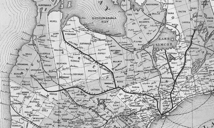
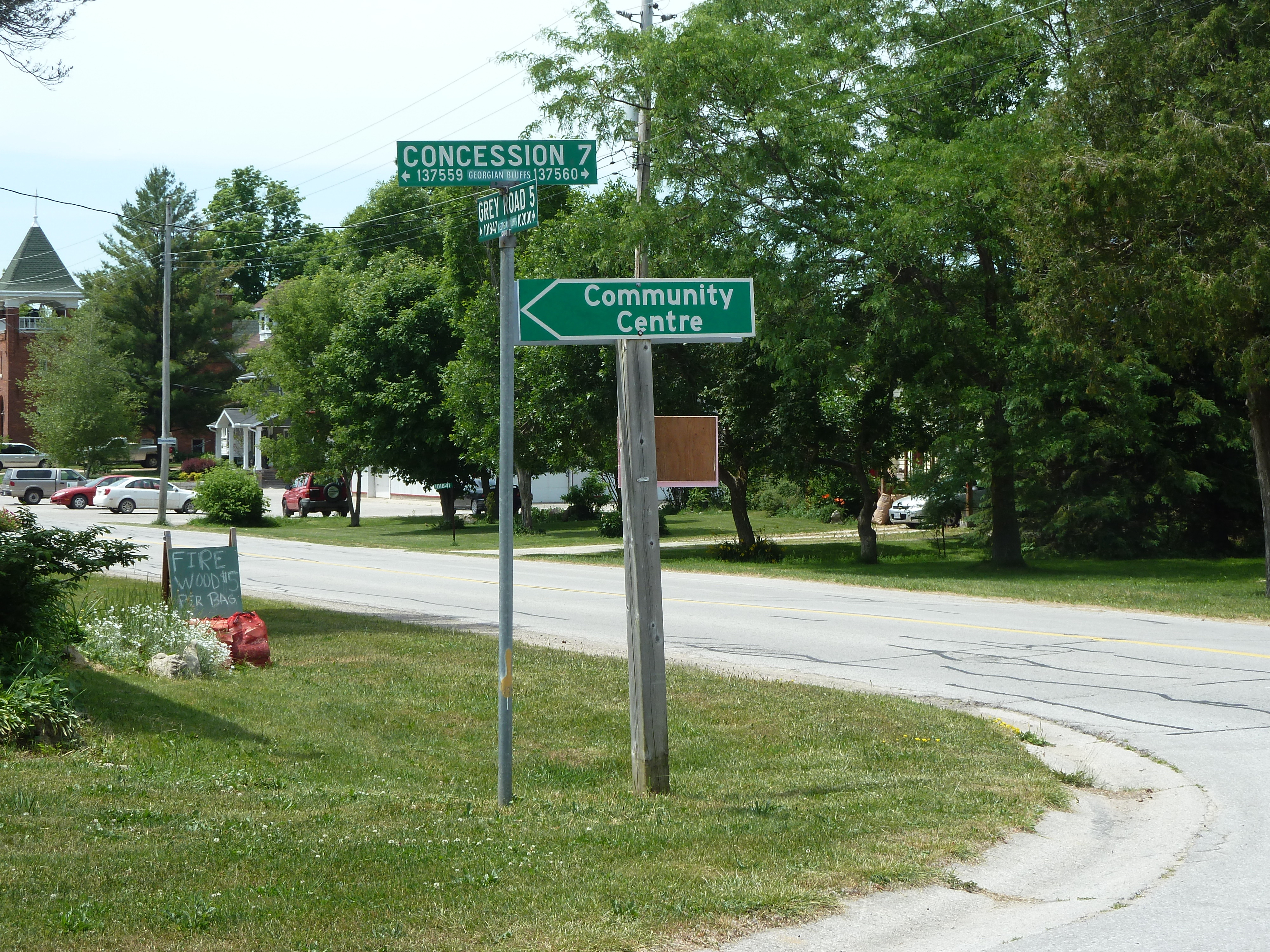
In the 1850s, railway building was booming. Over 2,000 miles of track were laid in the provinces of British North America. [i] By 1859 the Grand Trunk Railway ran from Quebec City, through Montreal and Toronto, to Sarnia, with extensions to Chicago, Illinois and Portland, Maine. Its rival, the Great Western, had lines from Niagara Falls to Windsor through Hamilton and London and connecting to Toronto.   The Northern Railway (previously the Toronto, Simcoe and Huron Railroad) reached Collingwood from Barrie in 1855.[ii] Jennie Fleming took this route for her trip to Toronto in 1869.[iii] But the great triangle of the Queen’s Bush along Lake Huron, the west half of Georgian Bay and south along the Garafraxa Road was unserved.   

Derby Township became involved with railway mania in July 1857 when Mr. Carney and Mr. W.A. Stephens came as a deputation from a railroad committee in Owen Sound – “to solicit a grant of money to aid in procuring the passing of the ByLaw for taking stock in the Toronto and Owen Sound Central Railway” (T&OSCR). Council was immediately enthusiastic and moved to set up a fund of 12 Pounds and 10 Shillings towards getting “sanction” from the ratepayers to buy ₤ 100,000. Further, Reeve Sam Jones and the Council expressed their thanks to the deputation “for affording them an opportunity of expressing their desire to see Railway communication afforded to the County of Grey and for honoring them with the first call for pecuniary assistance towards that object.” [iv]  The proposal, complete with routes, costs and benefits, and considerations, was documented by J.W. Tate in the Report on the proposed route of the Toronto and Owen Sound central railway.[v] The proposed route would run from Weston, up the Humber Valley to Mono Mills, across to Orangeville, north to Chatsworth and from there either along the Sydenham Valley through part of Derby Township or along another stream to the north of Owen Sound.[vi] 

Continue reading

All Hallow’s Eve, A Celtic Tradition

Did the Fleming families, who settled near Kilsyth, Derby Township, in the mid-1800s, partake in the Scottish tradition of All Hallow’s Eve?  Hard to know.  There is no mention of Halloween in family papers. As Disciples of Christ, they would have disapproved of pagan practices of ghouls and ghosts and the connection to the occult. But they may have retained something of the “All Saints” day on November 1 to remember the departed faithful.

Modern day, inflated plastic pumpkin - lawn ornament. 2021
Inflated plastic, artificially lit pumpkin 2021

We may think of Halloween as a North American excuse for spooky lawn decorations, jack o’lantern competitions, and costume dress-up for children going from door to door to get candy.  But Halloween has been much more, with traditions of bonfires and spirits more frightening than the inflated, lit, plastic ghosts we see today.

Halloween has its origins in Samhain (pronounced SAH-wane), a Celtic festival at the end of October when the spirit world became visible. The celebration marked the end of harvest and the beginning of winter and was an occasion to commune with the Otherworld – when spirits and faeries and the souls of the dead mixed with the living. Big bonfires kept people safe from the visiting evil spirits. Lanterns were fashioned by hollowing out turnips, carving scary features, and placing a lit candle inside to cast light and safety.  Children, to hide from the spirits, would go “guising” in costumes undercover as the malicious ones. Adults might do the same.  A song or a trick or just knocking on a neighbour’s door might earn them a treat.  For a game, they might bob for apples. (1,2,3)

Robert Burns recognized Halloween in his poem of that name in 1785. The first verse (in English translation) caught the night’s excitement of moonlight and movement.

Continue reading

The Kilsyth Subdivision

Main corner in the small village of Kilsyth, Georgian Bluffs, Grey County.
Kilsyth, Grey County, ON – Corner of Grey Road 5 and Concession Rd 7. Photo by Gwen Harris 2016

A new subdivision of 33 lots may be in the future for the sleepy town of Kilsyth west of Owen Sound in the Township of Georgian Bluffs (previously  Derby Township). The proposed subdivision of 33 residential lots on  17.09 hectares takes up most of  Lot 9, Concession 7 and some adjacent town lots at the south west corner where Grey Road 5 intersects Concession 7 (known as Mill Road).   This is just “down the road” from several farms the Fleming families once held.

MAP - Airphoto of the area of the proposed Kilsyth subdivision. Source: Grey County Committee Report 8 Nov 2018 regarding Kilsyth Plan of Subdivision (Barry’s Construction) 42T-2018-11
MAP – Airphoto of the area of the proposed Kilsyth subdivision. Source: Grey County Committee Report 8 Nov 2018 regarding Kilsyth Plan of Subdivision (Barry’s Construction) 42T-2018-11

The Proposed Plan for the Kilsyth Subdivision (2018) has much to tell us about the nature of the land the Flemings farmed, the current archaeological interest, the history of Kilsyth, along with enumerating the many compliance requirements concerning water resources, land use, ecology, habitat, and cultural heritage.  It is available from https://www.grey.ca/planning-development/planning-applications – look for Kilsyth on the page.

The “Fisher Archaeological Report” contains the background study and assessment that is of greatest interest for its examination of the history, soil conditions, and archaeology of the area and includes several maps of the area and photos of farmstead and artifacts that were unearthed. Two of these area maps are shown in this blog posting.

Continue reading