Owen Sound in the 1850s

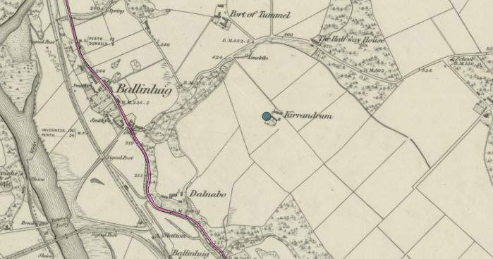
Jennie Fleming, the youngest of the Fleming family who settled in 1850 at Kilsyth, Derby Township, had deep memories of her pioneer days.

“As a frequent visitor in the early days to Owen Sound, Derby’s market place, she saw this hamlet on the arm of Georgian Bay grown from a little village of Sydenham into the thriving commercial town and city of Owen Sound. She sometimes recalled the fact that at first on entering the town she had to cross the Sydenham River on a log where the Second Avenue bridge [sic] now stands, and walk deep in mire on the main part of Poulett Street.”(1) [Roy Fleming, 1942]

Roy Fleming more than once recalled that in Owen Sound’s early days his Aunt Jennie crossed the Sydenham River by traversing – very carefully, we might surmise – a felled log, and then in town having to deal with the muck of the main street. One can imagine Jennie, a vital woman who lived into her nineties, reflecting on the changes she had witnessed since her arrival to the forested wilderness – walking long distances as a teenager, driving horse-drawn buggies on gravel-covered roads in her twenties, travelling by express trains to Toronto in her seventies.

Felled trees probably served as bridges in more than one spot – and in those years the tree could be at least three feet in width and easily tall enough to reach from bank to bank.  In 1841, according to Paul White in Owen Sound: The Port City, it was possible to cross the Sydenham River on the west side of town by tree. He wrote, “The only easily accessible crossing was to the south of the new community, at the present day site of the mill dam on 2nd Avenue West. Here, a tree had been felled and travellers could pass over the river by walking on the bridge created by the fallen log.”  (2)

Continue reading

Walking Kirrandrum

In June 2018 I had the great pleasure of visiting the Highlands of Scotland to walk the land of the Fleming home of Kirrandrum, the farm outside Ballinluig in Logeirait Parish.  I was guided by Eddie Thomson of Heartland Tours. We found the remains of Alexander’s house, which he built himself, and some of the other buildings, as well as the dry-stone wall Alexander built and which still stands intact. Most of all,  we saw surrounding hills and the Tay valley almost as they were when Roy Fleming and family members visited in 1903, and even as the Fleming family saw them when they left for Canada in May 1843.

A complete account of the visit with photos and video and reference to Roy Fleming’s description of his visit is provided in Walking Kirrandrum June 2018

The map below from Canmore shows the location of Kirrandrum relative to Ballinlluig and to the adjacent Dalnabo.

Ballinluig area showing Kirrandrum and Dalnabo. Source: Canmore - Ordnance Survey 1843-1882.
Ballinluig area showing Kirrandrum and Dalnabo. Source: Canmore – Ordnance Survey 1843-1882.

Visit to Cragganfearn

P1040348-cragg-sheep-2
Cragganfearn looking east – rock foundations, wall, and sheep in the background (Photo: G Harris)

Where there had once been a village of four families at “Upper Cragganfearn”, only the crumbling walls of a steading and the foundations to a few cottages and farm buildings remain.

Sheep graze in the fields of this quiet place. It was windy on the sunny June afternoon when Eddie Thomson of Heartland Tours led me to the site. Along the small stream, he pointed out the remnant of what might have been a sawmill. Past the gate, we could see a stone building that still stood high on the hill. We made our way uphill on a path and across the fields, nodding to the nearby sheep, to come to marvellous panoramic views of the hills. Continue reading

More maps and drawings at Scotlands People

National Records of Scotland has released to Scotlands People “more than 2,400 historic maps, plans and drawings”  that show country estates and plans of towns and cities.

See News Article: Maps and Plans Release (June 13, 2018).

Spanning four centuries, the collections cover both manuscript and printed topographical maps and plans. They are particularly strong in estate and railway plans; architectural drawings; and engineering drawings, particularly of ships, railway engines and rolling stock. More maps and plans will be added to the ScotlandsPeople website.

Requires free registration at Scotlands People to access and search

A search on Atholl delivers “Plan of the estates of Fincastle, Borenich, Lick and Duntaulich, Blair Atholl” (RPH6594). Dated 1832, this map shows the lands along the Tummel River.

Speaking of Scottish resources, Ancestral Findings offers this list of  Online Resources for Researching Your Scottish Ancestors.  Scotlands People and five others (including Family Search) are described here, and there are links to other postings related to Scotland.

Laird of Cragganfearn

Cragganfearn, Logierait Parish, Scotland in 2018. Photo by Eddie Thomson
Cragganfearn, Logierait Parish, Scotland in 2018. Photo by Eddie Thomson (https://www.heartlandtours.co.uk/)

Many families have a story from the past that takes on mythic qualities in the retelling. In genealogy, however, it is important to examine the story critically and evaluate the evidence. (1)

The Fleming family’s story has been about the “laird of Cragganfearn”,  the belief that Alexander Fleming’s grandfather had been “laird of Cragganfearn”, an estate of some 260 acres in the central part of the Atholl region of Perthshire. As the story goes, Alexander Fleming’s father, John, met his future wife Janet Ross at Cragganfearn where she was a servant. John’s father, the laird, banned the marriage and disinherited his son when John disobeyed. Very romantic, but how much is true? To be a laird means owning a substantial estate. Did a Fleming own that estate?

Others have wondered. In 2006 there was a heated thread at Rootschat in which three Fleming descendants sought information about the laird. One respondent (not a descendant) with the handle Tickle pointed out that the entire area had been owned by the Duke of Atholl in the 1700s, and that rental records at the Blair Estate in Blair Atholl (north of Logierait and Cragganfearn) would have the answer.

We examine the sources of this story, the information itself, and the evidence from land records and other accounts. We will see that the “lairdship” story began as wishful thinkin and continued thus. Continue reading